HYDRAULIC MODELING / HYDROLOGIC MODELING EXPERIENCE SERVICES
Let us help you with your modeling projects
Qualifications of key personnel; The knowledge and hydraulic modeling experience with the use of water quality and watershed models in Florida includes but is not limited to the following:
Spatially distributed hydrologic and hydraulic modeling and scaling using ICPR modeling software
Integration of hydrological and hydraulic models and remote sensing data into GIS
Surface and groundwater interactions modeling using XP-SWMM Modeling software
Spatial and temporal land cover dynamics and scaling, spatial analysis
Watershed characterization and modeling using Remote sensing and GIS
Evapotranspiration estimation using satellite imagery
SWMM hydraulic modeling (including groundwater recharge and event mean concentration water quality modeling) that simulates the full hydrologic cycle with continuous simulation seasonal modeling of long term rainfall (using DB-Hydro Database and BCB gauges) as part of the calibration and verification of the models.
Two-dimensional hydrodynamic and hydraulic modeling and water quality analysis of estuary and tidal marsh systems including the design of the field instrumentation program, the analysis of physical and water quality data, and the hydrodynamic and hydraulic modeling.
Water quality analyses, using the RMA4 constituent transport model to create a model for Nitrogen distribution within several coastal salt ponds.
MODFLOW 3D groundwater hydraulic modeling for consumptive use permits simulating groundwater drawdown on lakes and wetlands by pumping from wells and lakes.
Development and application of a groundwater/surface water interaction model, using MOD-HMS, to analyze the operations of the Marsh Driven Operations Plan for pumps and detention basins, under the guidance of no-harm criteria and the Everglades restoration goals.
Numerical hydraulic modeling in the areas of pollutant transport, surface and groundwater hydrology
Numerical hydraulic modeling of wave refraction and diffraction, sediment transport, and shoreline change using hydraulic modeling.
Hydraulic Modeling of the groundwater flow produced in the Surface Aquifer System (SAS) and subsequent groundwater quality analysis.
Developed a two-dimensional wave transformation hydraulic model, using MIKE 21, to study wave transformation, at site of proposed waterfront development project, through barrier islands and across the shallow bathymetry of the sound during severe storms.
Conducted a full harmonic study of the wave environment using the MIKE 21 Boussinesq wave model to characterize resonant harmonics and disturbance coefficients.
Finite element model simulations of storm surge caused by tropical storms and hurricanes using the ADCIRC hydrodynamic software developed by the US Army Corps of Engineers.
Potable water analysis with infowater hydraulic modeling techniques directly for Miami-Dade County WASD
Local Hydraulic Modeling / Hydrologic Modeling
Familiarity with South Florida water resources issues, constraints, policy influences, and stakeholder interests;
The Team engineers expertise in a broad range of South Florida water resources projects including all scales of modeling: hydrologic, hydraulic, hydrodynamic, flood protection, water quality; environmental services: permitting, environmental assessments, restoration and remediation; design of water control structures: dams, levees, canals, pump stations, culverts, tide gates; and program/project management. The work has been completed for clients in the Federal, State, municipalities, as well as the private sector.
Relevant externally funded projects of our team staff includes multidisciplinary engineering and science for watershed restoration hydrologic and hydraulic modeling applied to: Stormwater management master plans, Stormwater treatment, water quality assessments, flood control, water control structure design and modifications, water and wastewater infrastructure improvements, environmental assessments, environmental impact studies, environmental remediation, point and non-point source pollution control, and Total Maximum Daily Load (TMDL) investigations and permitting.
Hydraulic Modeling / Hydrologic Modeling Experience
List of Projects:
Kissimmee Basin Modeling and Operations Study: Our hydraulic modeling experts and researchers have participated in the various modeling tools being developed for this study to screen, formulate and evaluate alternatives to modify structural operations in the Kissimmee Basin in order to achieve a more acceptable balance between flood control, water supply, aquatic plant management, natural resource requirements of the Kissimmee River, the Kissimmee Chain of Lakes and downstream ecosystem impacts (Lake Okeechobee).
Development of RSM hydraulic modeling interface with the Everglades Agricultural Hydrology Model (EAHM): An interface modeling tool was written to link the SFWMDs RSM to the EAHM. This linkage code was written in C++ to allow both models to run simultaneously and exchange input and output information. This model interface was developed as a collaborative project between the SFWMD and the USDA.
Hydraulic modeling and Eco hydrologic Modeling of Marsh Driven Operations in Everglades National Park: The primary objective of this project was to develop and apply a groundwater surface water interaction model to analyze the operations of the MDOP for S-332B, S-332C, and S-332D pumps and detention basins, under the guidance of no-harm criteria and the Everglades restoration goals. This work was performed for the South Florida Ecosystem Office of the National Park Service.
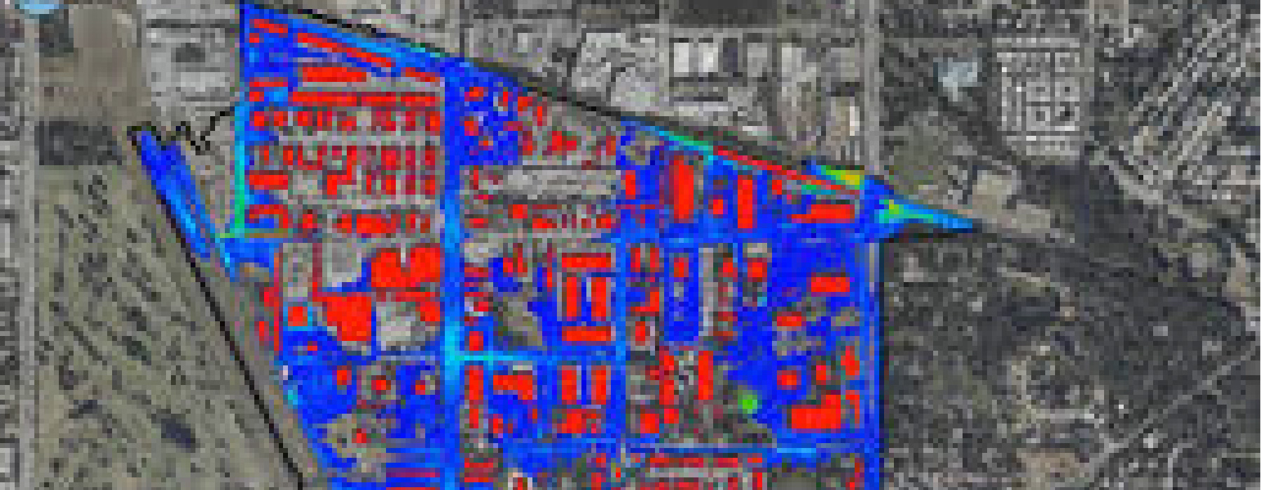
Updated the Western C-11 Stormwater Master Plan Facilities Update in Western Broward County for Central Broward Water Control District. The project included data collection
of hydraulic structures, basin land uses, water quality and seepage from Everglades. XP-SWMM hydraulic modeling and calibration to Hurricane Irene (1999) and No Name Storm (2000) , Flood Plain Encroachment Modeling for the 100 year 3 day storm (18.5 inches of Rainfall) to establish 100 year Flood Plain Elevation Criteria for all undeveloped land , and the planning for alternative design improvements (Culvert Replacements at key locations, Pump Stations, and Dredging). The hydraulic modeling included 65 Central Broward W.C.D. Sub-basins, South Broward Drainage District basins and pump station, the City of Weston’s basin and its two pump stations, South Florida Water Managements S-9 Pump Station, S-13A control structure, and Levee seepage flow data.Stormwater Management Master Plan, City of Doral, FL:
This project involved the development of a Stormwater master planning numerical hydraulic modeling in XP-SWMM. Modeling activities centered on defining the hydrologic parameters for model input, development of criteria for simulation of structural operations and analysis, QA/QC of modeling results, production of final reports and presentations to the client and the public.DERM-01Stormwater Master Plan C-6 Basin, Miami, Florida. (2003) The project’s scope of work was to utilize an existing basin master plan and try alternative design hydraulic modeling runs using XP-SWMM. The purpose for the project was to improve Flood Control and Water Quality within the basin. Design alternatives included exfiltration trench, dry retention areas, ponds, conveyance upgrades and Best Management Practices criteria changes for local municipalities.
SFWMD West Palm Beach Office, Comprehensive Everglades Restoration Plan (CERP) – Data Compilation for the Lake Belt and L31N Pilot Project, West Miami-Dade County, Florida. The two pilot projects are being conducted in order to address uncertainties prior to full-scale implementation of their associated components. We were responsible to contact private and public agencies and obtain applicable modeling data, QA/QC the data for applicability. Agencies that data was retrieved and reviewed: US Corps of Engineers, SFWMD, DERM, WASD, USGS, Everglades National Park, EPA, Florida Department of Environmental Protection, Florida Geological Survey, NOAA, UM, FIU and FAU.
Central Broward Water Control District, District Engineer Contract, Broward County, Florida. (1) Review of drainage design and related modeling for construction projects within the district. Plats, Paving-Grading and Drainage Plans, and Lake-Canal-Drainage As-Builts were reviewed and recommended to the District Board for Approval. Permittees included FDOT
District IV, FDOT Turnpike District, Broward County Engineering, Town of Davie, Town of Southwest Ranches, Cooper City, City of Hollywood, City of Sunrise, Broward County School Board, Geopak-BHA, Lennar Homes, GL Homes, Centex Homes, Rick Case Honda, Publix, St. Marks Church. (2) Modeling and design of several capital improvement projects including several culvert upgrades, CFD (FLOW-3D) model of a confluence of flow from two Stormwater pump stations pumping into the C-11 Canal directly across from each other. Hydraulic modeling and review of USACE spillway in C-11 canals to establish the head impacts on downstream sub-basins.Broward County Regional Central Park Modflow Groundwater Model: Reasonable assurance was provided by conducting groundwater hydraulic modeling. Scope included: Conducted a site vicinity environmental characterization using Federal, State, and local government database searches to identify potential and existing contaminated sites; Identified existing legal users and existing legal domestic users. Conducted supplemental irrigation volume calculations; Constructed MODFLOW groundwater models of the proposed groundwater withdrawal and demonstrated drawdown with respect to contaminated sites, existing legal users, existing legal domestic users, surface water bodies, and sensitive areas. The hydraulic modeling impact assessments were conducted for the proposed withdrawal alone and the proposed withdrawal with the accumulative drawdown of all existing legal users and pending applications. Proposed locations of recharge wells and surface water pumps, irrigation schedules based on need, wells and surface water withdrawals were simulated.
PG and E Indiantown Cogeneration Plant: Well Hydraulics, Water Quality and Groundwater Modeling: Contracted by PG and E to answer questions from FDEP on the impact of the cone of depression on a nearby user, particularly a superfund site (Ameristeel Site) north of the plant. Groundwater hydraulic modeling was performed for the geochemistry and the geology to determine the groundwater flow zones. Created contour maps of the groundwater flow and calculated the amount of drawdown on the Surface Aquifer System (SAS) from pumping the Floridian Aquifer. We then modeled the groundwater flow produced in the Surface Aquifer System (SAS). Groundwater water quality conditions were then evaluated based on modeling output.
Hydraulic Model Evaluation Study for Regional Scale Aquifer Storage and Recovery (ASR): This project involved the development of a procedure to evaluate numerical models for variably density groundwater flow with applicability to simulate ASR systems. In this project, hydraulic modeling activities centered on defining the criteria for model selection, evaluation of existing numerical models, development of a simulation tool with SEAWAT, production of final reports and presentations to the client and the public.
Stormwater Management Master Plan for Immokalee, FL: This project involved the development of a Stormwater master planning numerical
hydraulic modeling using XP-SWMM. In this project, modeling activities centered on defining the hydrologic parameters for model input, development of criteria for simulation of
structural operations and analysis/QA/QC of modeling results, production of final reports and presentations to the client and the public. Hydrologic and hydraulic modelingRe-engineering FLOW program for the SFWMD: The FLOW program is a FORTRAN-based hydraulic model used by the SFWMD for calculating flow from culverts, spillways, weirs, and pump stations. The re-engineering work included reviewing the algorithms and the source code, the data transmission between FLOW and the databases DBHYDRO and DCVP, and developing and testing a new program (named NFLOW) to replace the existing FLOW.
Method assessment for determination of appropriate sediment TMDL endpoints in Oklahoma: This project involved the development of a specific protocol for defining sediment Total Maximum Daily Load (TMDL). The project involved the statistical analysis of the habitat difference among 54 reference and impacted streams in the State of Oklahoma, adapting the SWAT model (Soil and Water Assessment Tools) to calculate flow and sediment loading from four Oklahoma watersheds, and the development of a model, based on Yang’s Unit Stream Power Formula, to calculate sediment transport in river channels.
Surface energy flux from agricultural fields using remote sensing: This study analyzed Landsat imagery of wheat and soybean fields in Northwestern Minnesota from 1997-2002 to study the latent heat flux from the two field employing the SEBAL model. The study also correlates yield to the modeled latent heat flux.
Energy-carbon flux linkage: Use of ANN and remote sensing in estimating carbon and energy fluxes: This study used ANN technique to couple the carbon and energy fluxes for the grassland, forest and agricultural ecosystems. A separate study also used remote sensing-based energy fluxes and land surface parameters (net radiation (Rn), soil heat flux (G), sensible heat (H), latent heat (LE), emissivity (e), albedo (a), normalized difference vegetation index (NDVI) and surface temperature (Tsur) to compare two grazing fields of different grazing density in Mandan, North Dakota.
Caribbean Coastal Scenarios: This project aimed at gathering and developing ecohydroclimatological database for coastal watershed of Jamaica, Dominican Republic, Cuba and Puerto Rico, modeling delivery of water, sediment and nutrients to coastal waters and development of practical scenarios of land-cover and climate change and their impact on the coastal biodiversity and marine biota.
Transboundary Water for Biodiversity in the Mara River Basin, Kenya and Tanzania: Supported by USAID, the two year project will work closely with local collaborators in Kenya and Tanzaniato understand the role of transboundary river (Mara River) in maintaining the biodiversity in the lower basins of Mara. This will involve hydrological modeling to estimate the spatiotemporal variability of the flow, the effect of water abstractions on the ecological functions of the Game Reserves and National Parks.
Kissimmee River ecohydrological restoration evaluation using MODIS Data: This study uses MODIS-based fractional vegetation cover latent heat flux to evaluate the temporal and spatial changes as a result of the restoration.
Impervious surface area (ISA) dynamics of South Florida: Spatiotemporal dynamics of ISA mapped using Landsat images and changes are used to explain the hydrologic and flood frequency changes of the area. hydraulic modeling
Eutrophication of Florida Bay: using ANN, level of algal blooms (Chlorophyll a) was predicted from other environmental and water quality data. Publication highlighting this finding is accepted in Journal of Coastal Research hydraulic modeling
An Evaluation Modeling Approach of Contaminants of Concern under the Source Water Protection Program for the State of Florida: This study addressed, at least, two fundamental aspects of the source water protection program priorities in the State of Florida: a) identifying potential surface and groundwater contaminants from industries, crops and other potential groundwater polluting sources; and b) developing a scientifically based model, with a ranking scheme, that uses toxicity, mobility, and relative amounts of specific contaminants to identify and rank the top three contaminants of concern by industry and crop. The ultimate purpose of this project was to support programs that comply with federal and state laws, which call for the protection of groundwater supplies in the State of Florida. hydraulic modeling
A Case Study of Modeling and Evaluation of a USA Southeastern Watershed: This study is tests the ability of modeling to simulate the hydrologic and hydraulic modeling behavior of a watershed as a holistic approach to manage non-point source (NPS) runoff and pollution. The Simulator for Water Resources in Rural Areas Water Quality (SWRRBWQ), a watershed management computer code, was implemented and evaluated. Its capacity to simulate water yield and other variables for two of the Little River experimental watersheds in Georgia was evaluated. The watersheds (i.e., watershed B and its sub watershed K) are part of the Upper Little River System in the Gulf-Atlantic Coastal Plain of the southeastern United States. The prime objective was to simulate monthly and annual water yield. Water yield was the key indicator to evaluate the predicted, individual and comparative, hydrologic behavior of the two watersheds and to define prediction effectiveness.
Development and Evaluation of a Geographic Information System Based Method to Estimate Flooding Susceptibility in an Area of Broward County, Florida: This investigation developed a GIS-based multi-class index overlay model to determine areas susceptible to inland flooding during extreme precipitation events in south Broward County. hydraulic modeling. Florida. The investigation used airborne laser terrain mapper elevation data and depths estimate from the US Soil Conservation rational formula. The method shoed some potential as a predictive tool for flooding susceptibility but needs further optimization.
Development of a Mathematical and Computer Model to Assess Water Quality Impacts of Hazardous Compounds from Minor Gasoline Spills in the Inter-tidal Zone of the Miami River, Florida: The objective of this investigation was to develop a model to predict transport and fate of gasoline components of environmental concern in the Miami River by mathematically simulating the movement of dissolved benzene, toluene, xylene (BTX), and methyl-tertiary-butyl ether (MTBE) occurring from minor gasoline spills in the inter-tidal zone of the river. Computer codes were based on mathematical algorithms that acknowledge the role of advective and dispersive physical phenomena along the river and prevailing phase transformations of BTX and MTBE. Phase transformations included volatilization and settling. The model uses a finite-difference scheme of steady-state conditions, with a set of numerical equations that was solved by Gauss-Seidel iteration. A numerical validation process was conducted by comparing results with analytical and numerical reference solutions. Sensitivity analysis and other user-friendly software were built-in with the model code embedded. This computer model can be used for the rapid assessment and management of the effects of minor gasoline spills on inter-tidal riverine water quality.
A hydraulic modeling study on the Hydraulic Regimes of the Miami River, Miami-Dade County, Florida: This investigation fills up a gap in the understanding of the hydraulics of the Miami, River in Miami-Dade County, Florida. First a historical overview is provided with emphasis on the changes to the natural system. Available data was qualified to estimate the range of flow regimes and associated indicators, including Froude Numbers and characteristic regimes. A critical analysis was included to estimate the pros and cons of available data as a basis to establish volumetric balances in support of contaminant transport analysis. hydraulic modeling
aa.
Applicability of the Stream Water Quality Model QUAL2E to Slow Velocity Subtropical Canals in Florida: This investigation assessed the applicability of the stream model QUAL2E in
modeling the Tampa Bypass Canaland the Caloosahatchee River in Florida, both being slow velocity subtropical canals. Verification, calibration and validation were conducted. Hydraulic parameters used predictions from the hydraulic routines of model HEC-2. Simulations were conducted to evaluate the impact of nutrient laden water from the Everglades Agricultural Area.bb.
Evaluating the Effectiveness of a Delineated Wellhead Protection Area in Dade County ,Florida: the Northwest Wellfield : This effort addressed the comparative evaluation of the effectiveness of the Wellhead protection Program (WHPP) in the North Wellfield of Miami-Dade County, Florida. Conclusions and recommendations were critically offered regarding the impact of land uses and zoning criteria. WHPA and WHEM were models included in the comparison